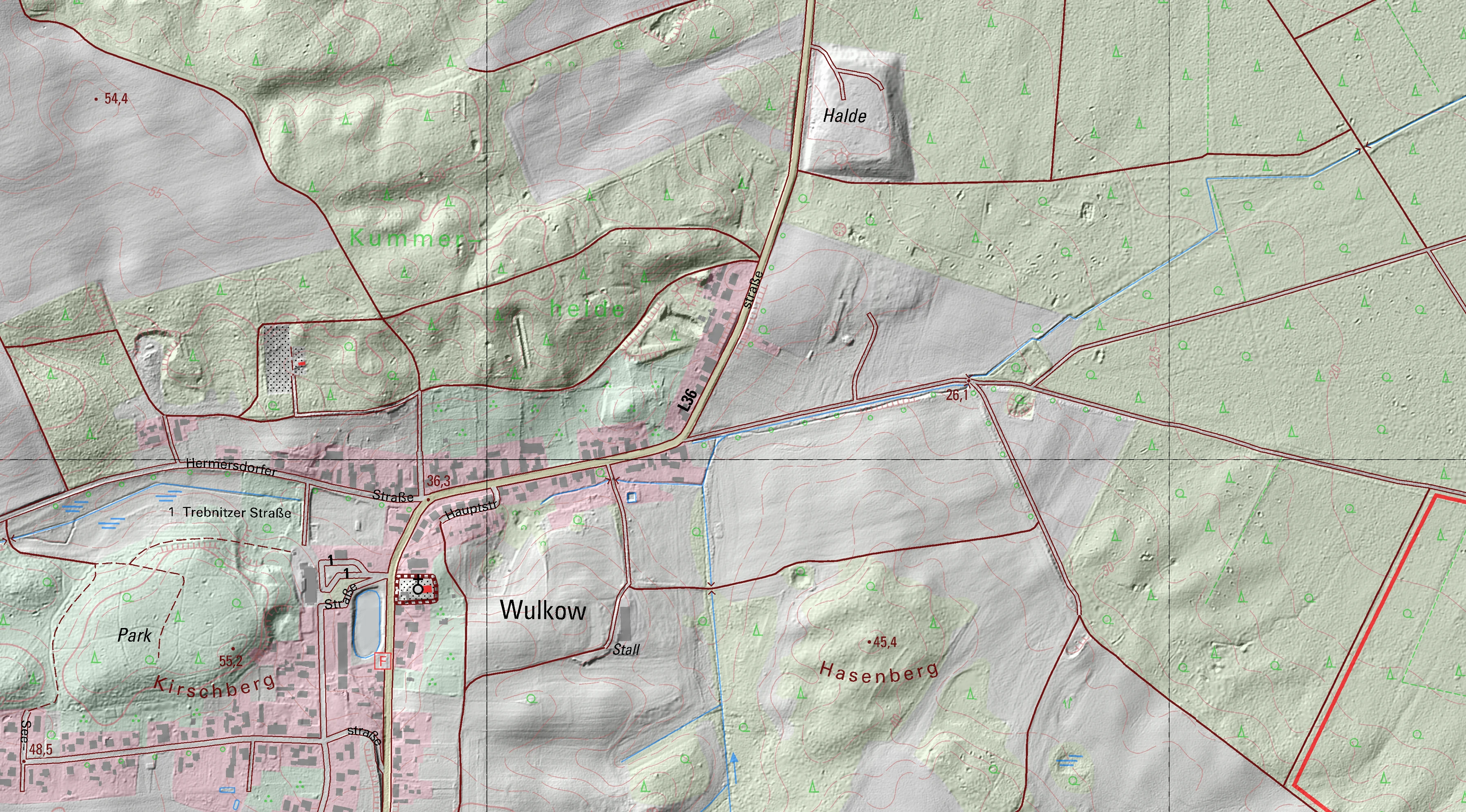
Searching for traces
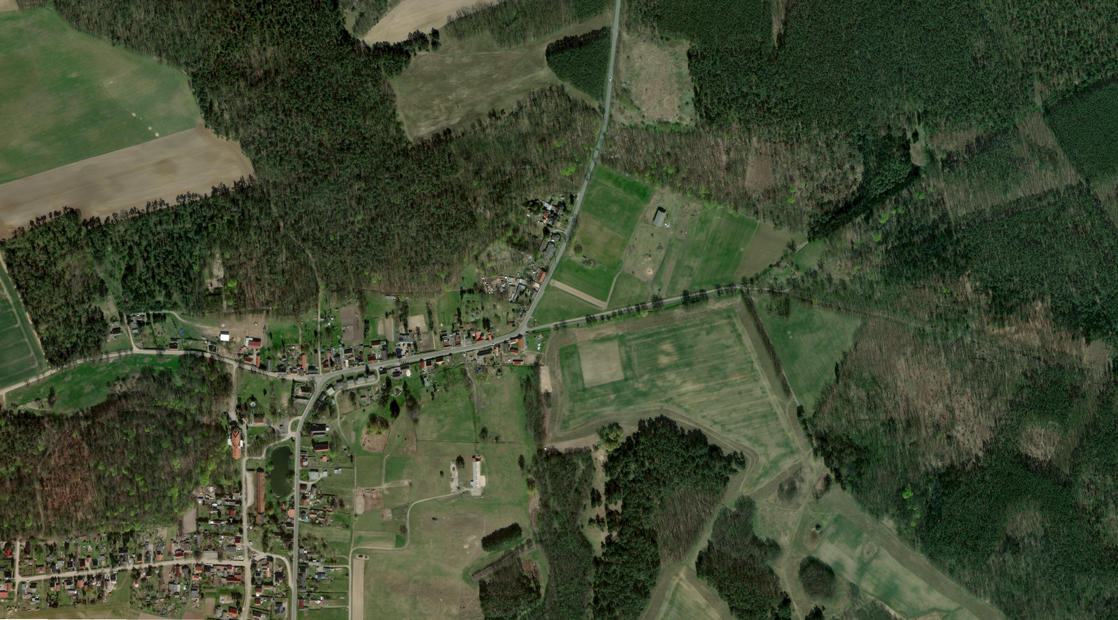
- Aktuell: © ESRI World Image • https://opendata-esri-de.opendata.arcgis.com/
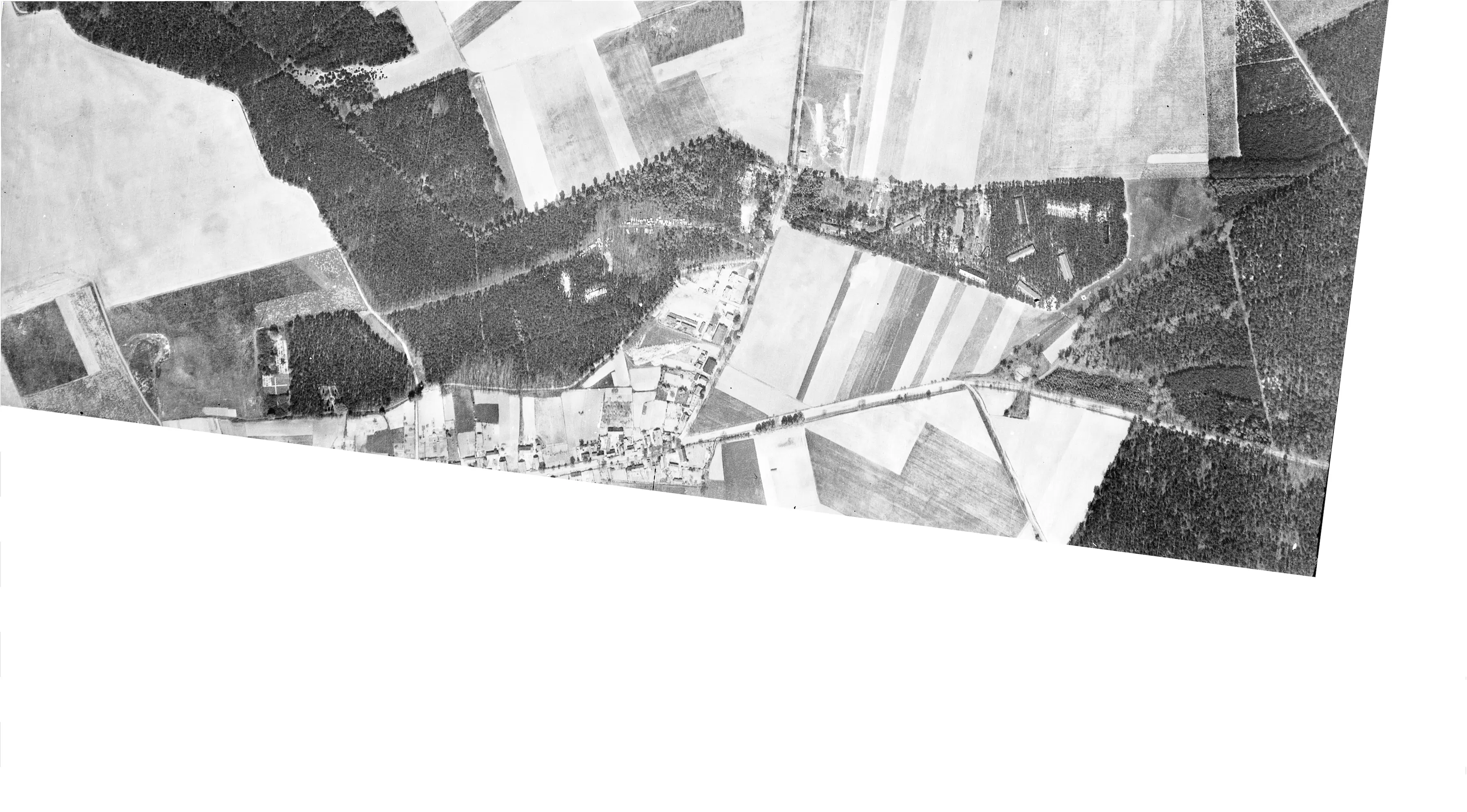
- 1944: © Luftbilddatenbank Dr. Carls GmbH
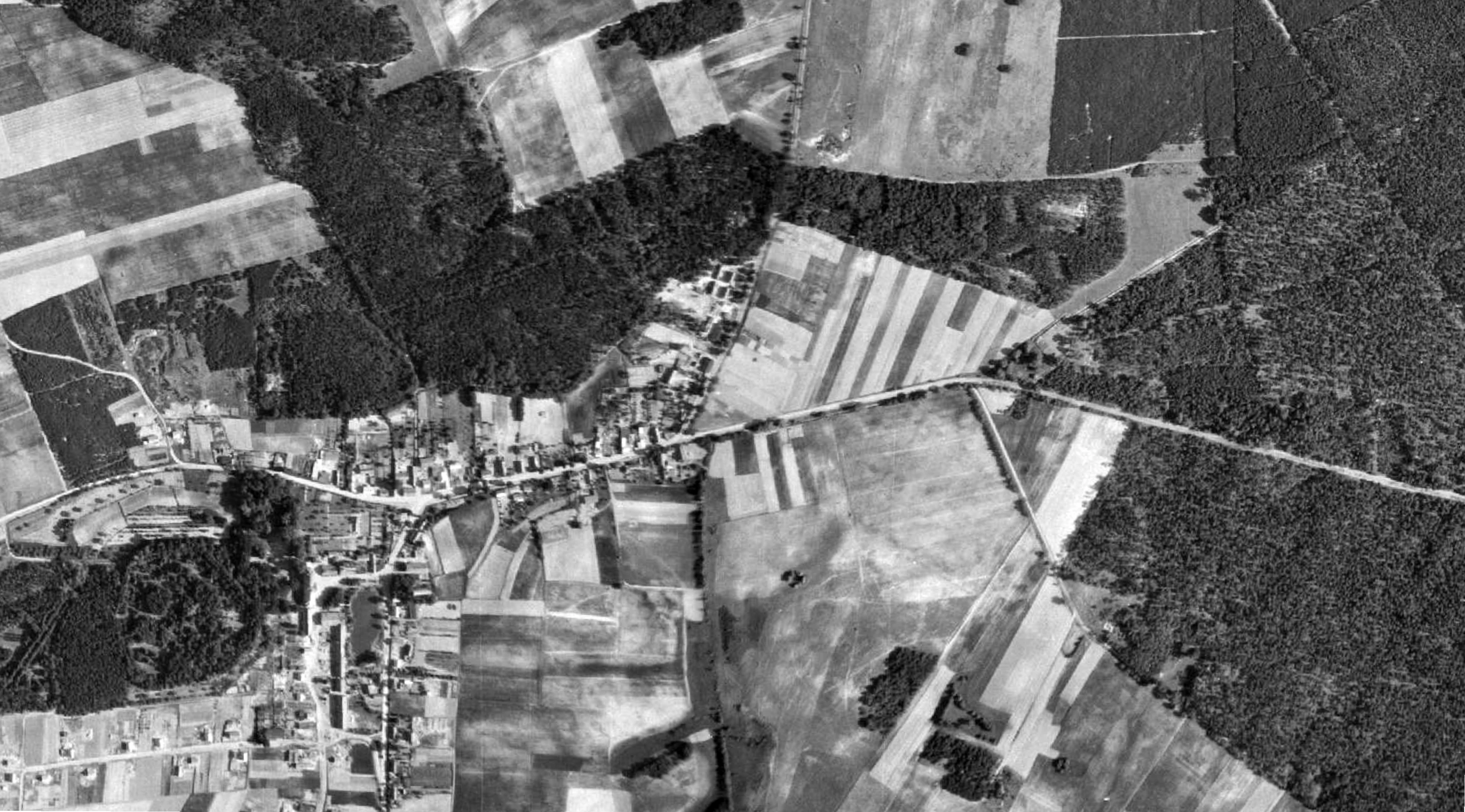
- 1953: © OpenStreetMap contributors, Historische Orthophotos 1953 (BRB)
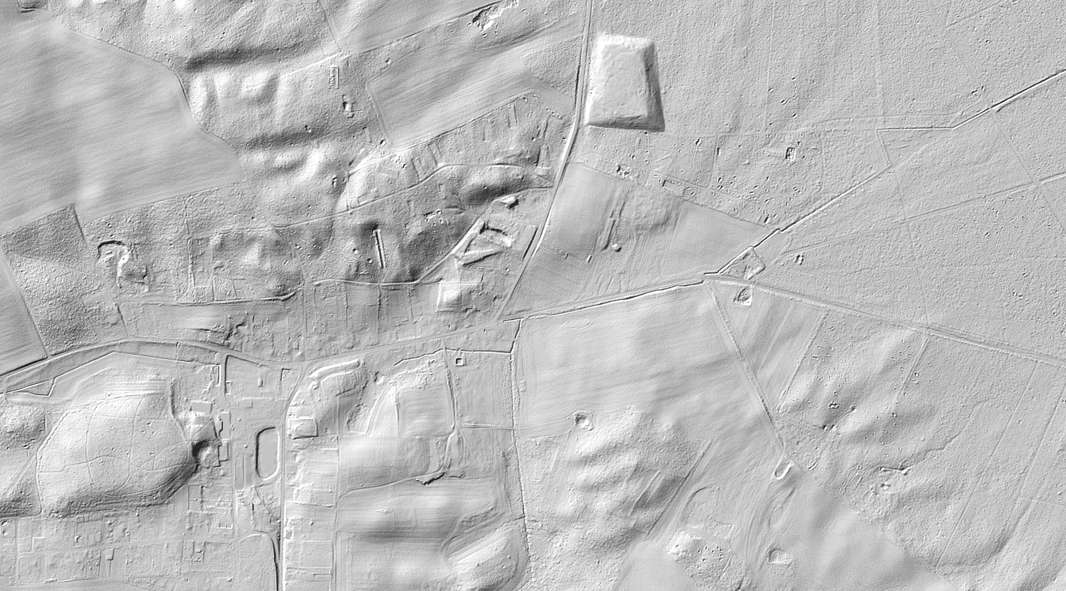
- DGM1 und DTK10: © GeoBasis-DE/LGB (2024), dl-de/by-2-0, Daten geändert
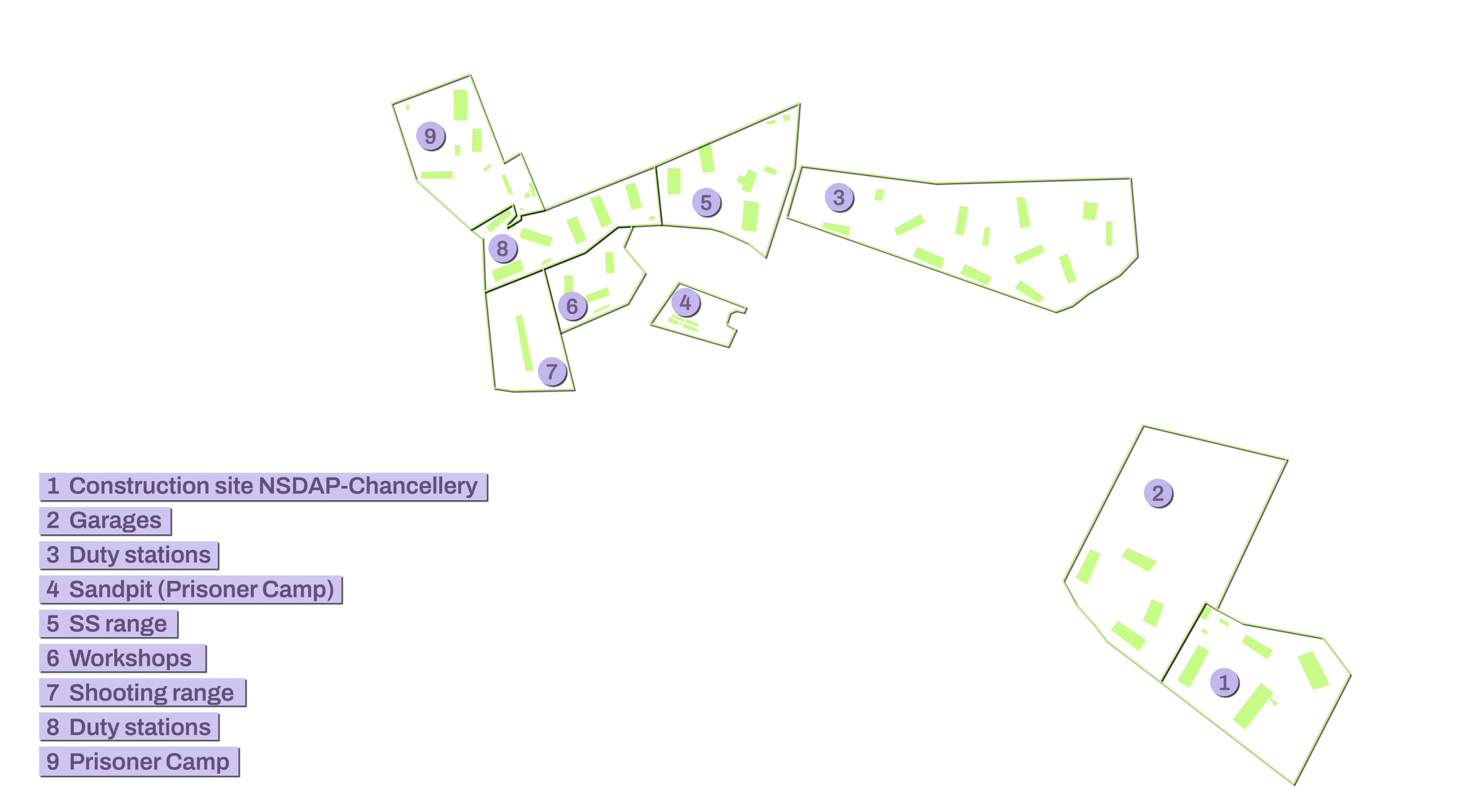
The Wulkow camp was demolished after 1945.
Traces are still visible from the air today.
Two aerial photographs from the construction period in May 1944 and after dismantling in the summer of 1953 bear witness to this.
A laser scan reveals the contours of the buildings on the forest floor.
More from „The Camp“